Autonomous platforms
Finnish Meteorological Institute maintains a multiplatform marine observation network in the Northern Baltic Sea. The network includes Argo-floats for open sea hydrographic profiling, ice drifters, wave buoys, and bottom-mounted moorings for hydrography, currents and sea-ice thickness measurements. Most of the operational data is available through FMI open access data portal.
FINMARI partnership has established a network of 4 profiling buoys close to the four main field stations.
The newest investment is the Benthic Lander, which is used for observing interactions between the sea floor and water column.
Argo Floats
Argo is an international observation system for measuring temperature, salinity, currents and bio-optical properties in oceans. The international program has been operational since the early 2000s. The observations are based on free-drifting profiling floats, operating autonomously for extended periods and delivering their data via satellite connection when visiting the surface. Currently, the global Argo fleet consists of almost 4000 drifting "Argo floats" worldwide (click the map below to see today's situation).

The global Argo fleet, consisting of ca. 4000 drifting "Argo floats" worldwide.
Image: Argo project, UCSD
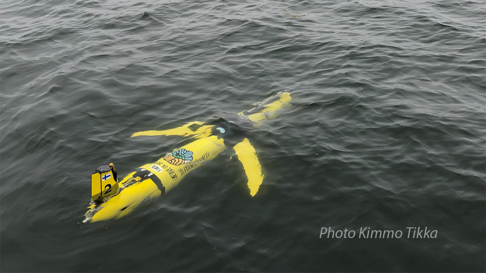
FMI operates three Argo floats in the Baltic Sea, two in the Bothnian Sea and one in the Gotland Basin. These Argo floats have been adapted to shallow water conditions. One of the Argo-floats measures temperature and salinity profiles in the Bothnian Sea daily, while the other two are equipped also with oxygen and chlorophyll-a sensors and measure their profiles weekly. The Finnish Argo floats are part of the Euro-Argo ERIC research infrastructure.
Contact
Dr. Laura Tuomi, Finnish Meteorological Institute
Simo-Matti Siirilä Finnish Meteorological Institute
Links
Gliders
An ocean underwater glider is an autonomous, unmanned underwater vehicle used for measuring physical and chemical parameters , e.g. temperature, salinity and chlorophyll, depending on the sensors they are equipped with.
The gliders regulate their buoyancy, diving at angle slowly to pre-set depth, rising again to the surface, and sending by satellite connection the data collected during the dive. Their mission can be remotely controlled by sending route commands during surfacing. They are suited for collecting data in remote locations, safely and at relatively low cost. The gliders are able to travel far distances over periods of weeks, even months, without servicing.
FINMARI has currently two Slocum underwater gliders "Uivelo" and "Koskelo", which are owned and operated by the Finnish Meteorological Institute FMI.
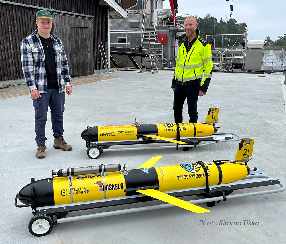
Uivelo
- Slocum G2 30/200m, 2016-
- SBE CTD, Aanderaa oxygen optode, SBE SeaOWL fluorometer (Syke)
Koskelo
- Slocum G3 200m, 2023-
- SBE CTD, Aanderaa oxygen optode, SBE SeaOWL fluorometer
- Sequoia LISST-Glider (FINMARI/Syke)
- Sequoia Tau transmissometer
- Soundtrap ST600HF HydrophoneThe glider measures temperature, salinity, oxygen, chlorophyll, turbidity and organic carbon compounds (CDOM) in the water.
Contact
Dr Laura Tuomi Finnish Meteorological Institute
Kimmo Tikka Finnish Meteorological Institute: gliders
Profiling buoys
Profiling buoys are automated devices for measuring salinity, temperature, dissolved oxygen,turbidity, chlorophyll-α, and blue-green algae content in the whole water column. A winch moves the measuring platform several times a day from surface to bottom, and the data are delivered wirelessly in real time.
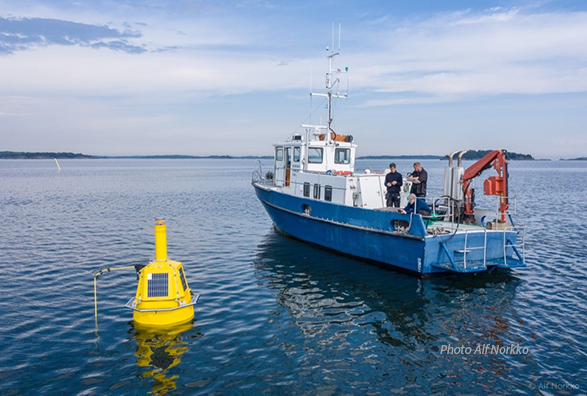
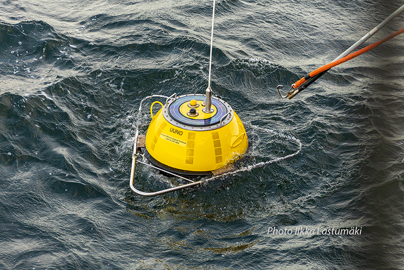
Daployment of a profiling buoy from RV Aranda outside Utö, and maintenance of another profiling buoy outside Tvärminne Zoological Station.
FINMARI has currently three moored profiling buoys in the vicinity of Tvärminne /UHEL, Seili /UTU and Utö Atmospheric and Marine Research Station). The buoy network yields high-resolution data on seasonal stratification dynamics, which are important for the coupling of the productive surface layers and the seabed. These material fluxes are highly relevant for eutrophication dynamics of coastal systems.
Contact
Lauri Laakso Finnish Meteorological Institute
Jari Hänninen Archipelago Research Institute
Joanna Norkko Tvärminne Zoological Station
Links
Wave buoys
Finnish Meteorological Institute has four operational wave buoys in the Baltic Sea. Wave measurements are also made in other areas during research campaigns. Wave buoys provide observations of significant wave height, wave direction and period. Also sea surface temperature is measured by the wave buoys.In addition, FMI has one online Acoustic Doppler Current Profiler (ADCP) measuring waves.
Contact
Doc. Heidi Pettersson Finnish Meteorological Institute
Links
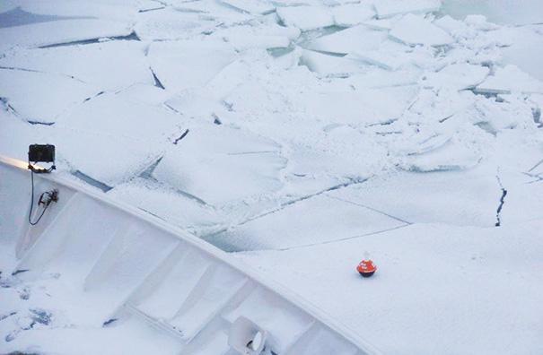
A wave buoy in water, and an ice buoy on drifting sea ice.
Ice buoys
FMI uses GPS-Iridium ice drift buoys (MetOcean) to measure sea ice drift in the Baltic Sea. A buoy tracks its coordinates, air pressure and sea surface temperature (when in open water) every 3 hrs.
Every winter, 4-6 buoys are deployed on the sea ice at the Baltic Sea for validation of SAR imagery based sea ice drift and for operational sea ice monitoring.
Additionally, few buoys have also been deployed in the Arctic (e.g. two buoys to the central Arctic by German R/V Polarstern in August 2014).
Contact
Dr Laura Tuomi Finnish Meteorological Institute
Marko Mäkynen, Finnish Meteorological Institute: ice buoys
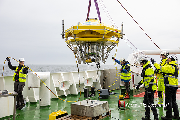
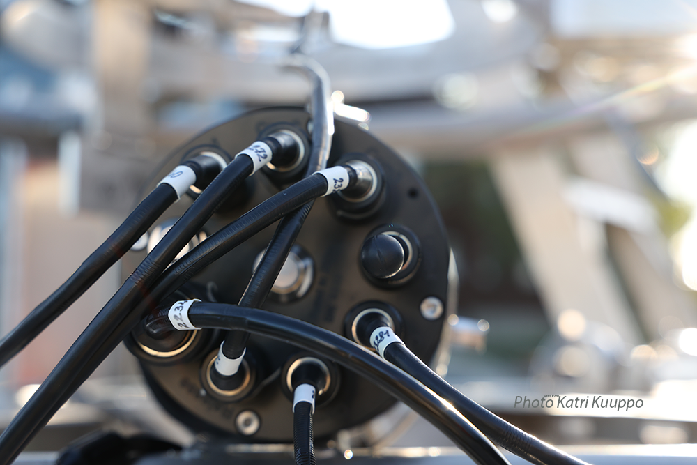
Benthic Lander
Benthic Lander is an observation platform for measuring benthic-pelagic coupling. It is deployed on the seabed to record physical, chemical or biological activity autonomously for several days to months.
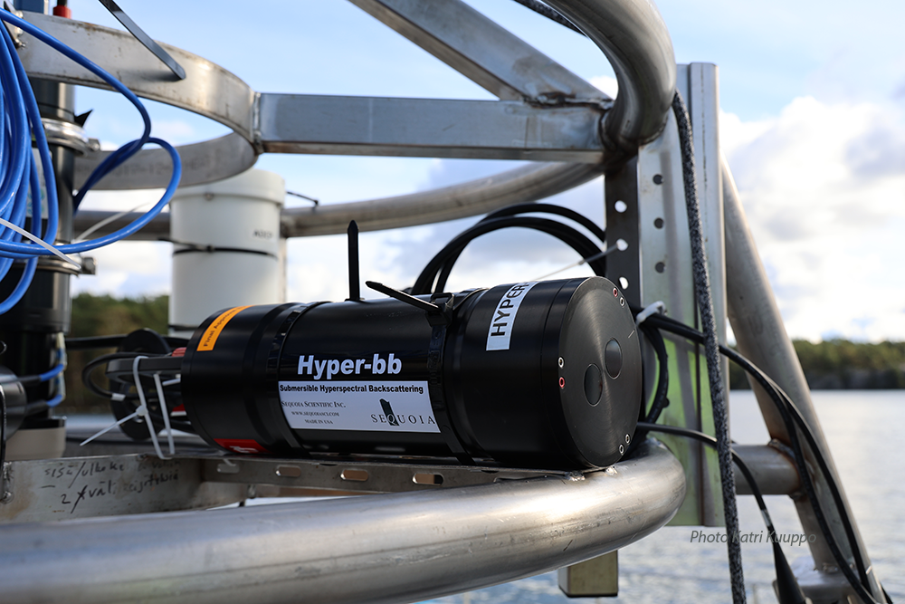
The benthic lander steel frame is equipped with sensors. FINMARI is able to measure
- pCO2 CH4 O2 H2S/pH/T and PO4 (Contros/4H-Jena, Aanderaa, Sea&Sun Technology/AMT, WetLabs/SeaBird)
- 3D profiler, ADCP SeaWatch 1200 kHz, LISST-100X particle detection and AQUAscat suspension profiler (Marine Electronics, Rowe, Sequoia and Aquatec)
- Central logger and acoustic modems (Develogic)
The Benthic lander is a collaborate intestment of Syke and GTK and is operated by both institutes.
Contact
Joonas Virtasalo Geological Survey of Finland GTK
Sami Kielosto Finnish Environment Institute Syke
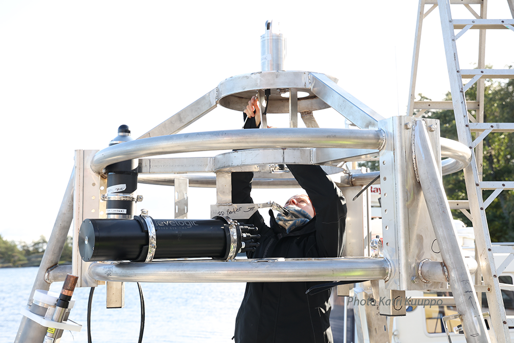
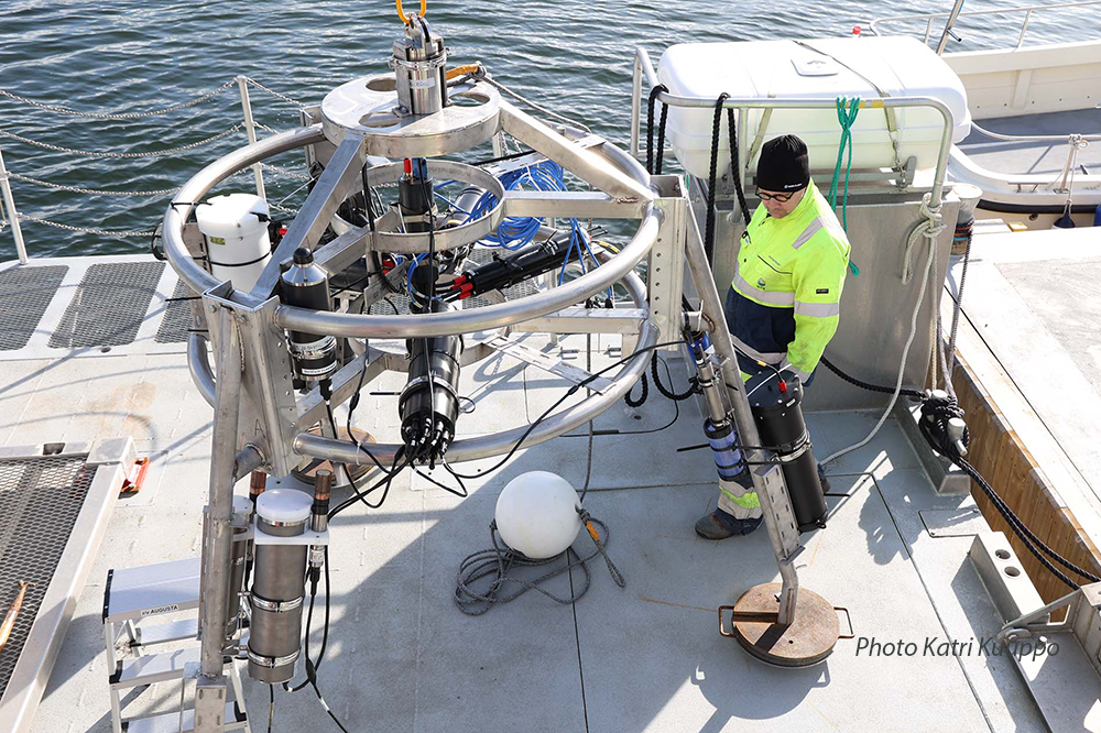
Benthic Lander: instrumentation, and ready for deployment